
Hermes - PRT
Athens network
This is the simulated network
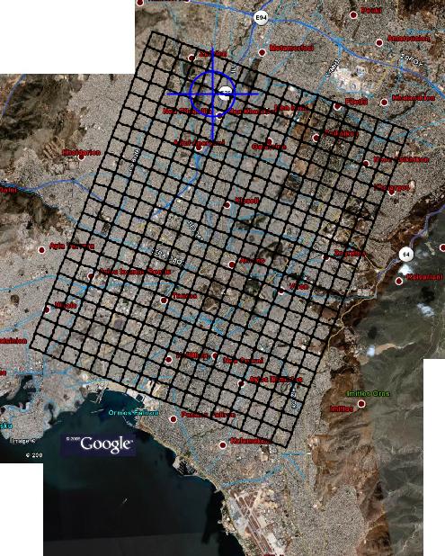
It has 752 stations. Lines are spaced every 600 meters, therefore any point in the city is at most 300 meters away from a station (3-4 minutes walking).
According to the simulation this network can serve 124.000 trips in 30 minutes (248.000 trips/hour) . To achieve this 37.214 vehicles were used. The average trip length was 8.1 km.
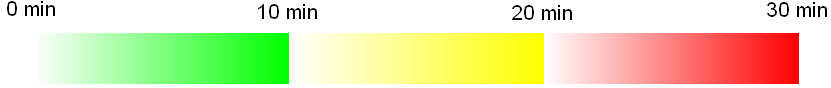
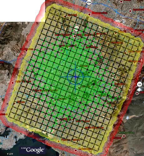
In the maps below you can see how far one can go using the network, starting at a specific point. (calculations include walking and queuing at stations)
|
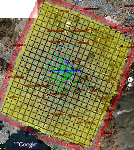
Starting at a station at the center of the network: About 40% of the city is accessible within 10 minutes. Almost the entire city is accessible within 20 minutes. |
|
Starting at a point in the center, 3-4 minutes away from a station: A small part of the city is accessible within 10 minutes. Almost the entire city is accessible within 20 minutes. |
|
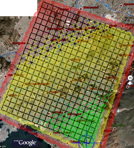
Starting at a station at the south end of the network: A small part of the city is accessible within 10 minutes. 70%-80% of the city is accessible within 20 minutes. The rest is accessible in 30 minutes. |
|
|
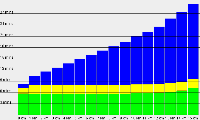
Average trip time (90000 trips random origin/destination): Blue=time on guideway Yellow= queueing / delays / station operations Green = walking time |
|
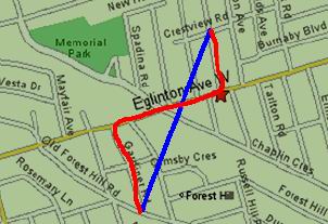
Note: On the above bar graph as distance is meant the straight origin-to-destination line , not the distance actually travelled E.g. in the left picture the blue distance , not the red one. |
Under overloading conditions the network can service up to 307.000 trips / hour. In this case however waiting times at stations are larger and the final commuting speed is lower.